Apache USV solutions in the Russian bathymetric survey projects
APACHE 3 USV was launched by CHCNAV in May 2020, and today it is one of the most competitive professional USV solutions for bathymetric surveys in Russia. It provides uninterrupted survey even when passing under bridges and integrates dual GNSS positioning and heading receiver, hull attitude and IMU sensor.
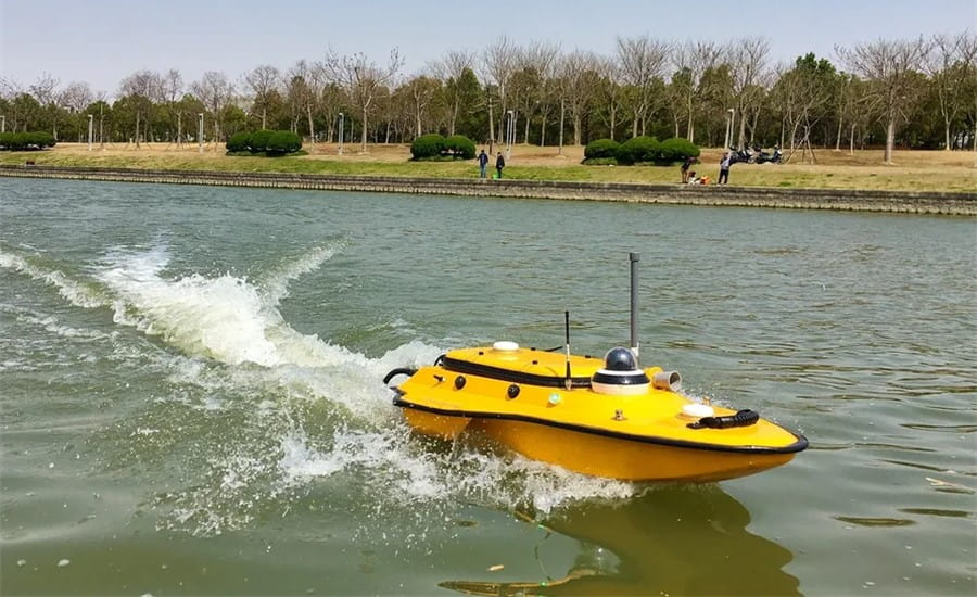
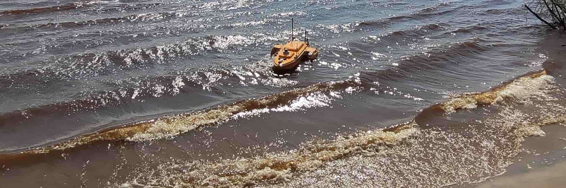
Figure 1. Apache 3 USV mapping a lakebed.
CJSC LenTISIZ, a Russian company that has been providing engineering services since 1962, purchased CHCNAV's Apache 3 single-beam USV in late 2020 for hydrometric and hydrographic survey work. LenTISIZ proved the Apache 3 to be a very effective marine drone after it completed the mission to measure the water depth of the Neva River as part of the project to rehabilitate its embankments.
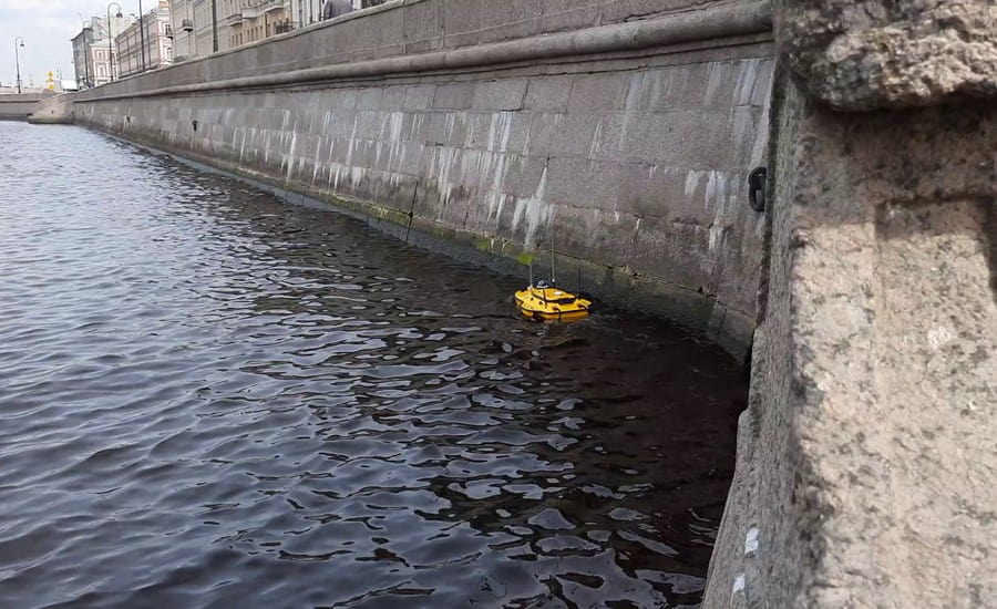
Figure 2. Apache 3 USV on the Neva River, Russia
Previously, these bathymetric surveys had to be carried out by a small manned vessel, but the Apache 3 USV has made it possible to move from a traditional operating mode to a fully autonomous, remotely controlled navigation operation. In this way, this marine drone can easily reach waters that are difficult to access with a small vessel. LenTISIZ told us that with the help of Apache 3, they have increased work efficiency, reduced work intensity and improved output quality.
____
Another marine drone from CHCNAV, APACHE 6 USV multibeam USV, a fully integrated innovative solution for 3D bathymetric survey, underwater object positioning, offshore construction, underwater archaeology, and wrecked rescue, has already started its operation on the Northern Dvina, a river in northwestern Russia; ‘SONAR,’ a geodesic company, was the first to purchase the Apache 6 USV in Russia in 2021.
Its large size and superior stability differentiate the Apache 6 multibeam USV. It can be instrumented with a multi-beam echo sounder, side-scan sonar (SSS), and LiDAR scanner. SONAR plans to use the Apache 6 for hydrological and geodetic surveys and dredging, water conservation projects, retrieval of sunken objects and water measurement. The use of this unmanned surface vehicle is particularly crucial for specific tasks that cannot be performed by manually operated vessels.
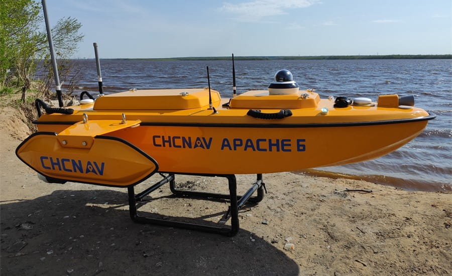
Figure 3. Apache 6 USV and the Northern Dvina River, Russia
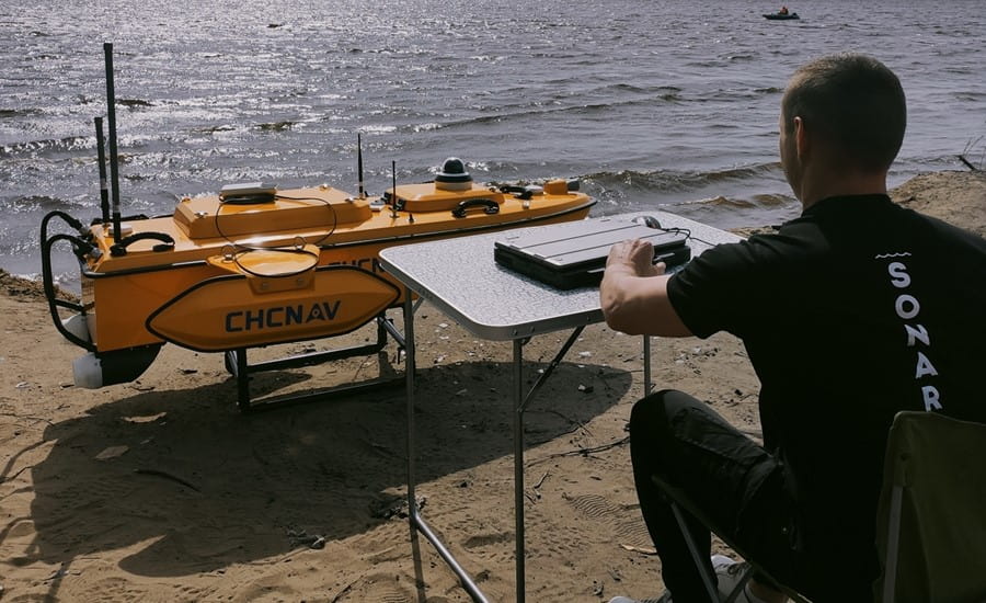
Figure 4. Apache 6 USV is under preparation for the Northern Dvina River survey in Russia
"The main purpose of Apache 6 is to help us carry out surveys where the use of large vessels is expensive or impractical," said Dmitry Potapov, CEO of SONAR. "The Apache 6 has already been used to complete a water depth survey in the construction area of a coastal protection project in Severodvinsk City. We plan to carry out depth measurements and water investigations in the quayside area in the near future. In addition, we will be working in water reservoirs of limited size, such as shallow ash disposal areas of thermal power plants, settling basins and other sites.”
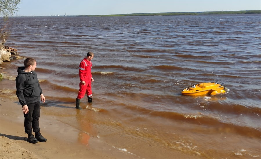
Figure 5. Apache 6 USV on the Northern Dvina River, Russia
CHCNAV experts, represented by PRIN in Russia, provided training to SONAR personnel in Arkhangelsk, a regional center in Northwestern Russia. Although the training took place in a difficult environment, with wind gusts of up to 13 m/sec, the Apache 6 still completed its mission and provided accurate bathymetric survey results of the northern coast of the Dvina River, near the Krasnoflotsky Island.

Figure 6. From left to right, Philipp Golovchenko, Ph.D., Head of USV department at PRIN, and Anton Matveev, Senior GNSS & USV Systems engineer at PRIN.
Nowadays, APACHE 3 and 6 USV are already widely used in Russia for the following tasks:
· Determination of the depth of reservoirs, mapping the bottom of rivers, lakes, reservoirs, coastal areas of the sea.
· Conducting engineering and hydrographic surveys during the construction and operation of any hydraulic structures.
· Monitoring of the bottom surface in the water area of hydraulic structures.
· Creation and updating of navigation maps.
· Channel surveys.
· Carrying out works for the subsequent purification and restoration of natural water bodies (silt removal, dredging works).
CHCNAV's marine drones have made hydrographic surveying more accessible and cost-effective not only in Russia but also in many countries around the world. Ease of transport, high operational speed, employee safety and ease of use are among the benefits that Apache USV clients can enjoy today.
____
Know more about APACHE 3 USV and APACHE 6 USV
Send an inquiry for APACHE 3 USV and APACHE 6 USV