facebook icon linked_in icon youtube icon twitter icon instagram icon
Find a Dealer
CHC Worldwide
  • CHC Navigation - Corporate Headquarter
  • CHC Navigation Europe
  • CHC Navigation USA LLC
  • CHC Navigation India
English
  • Français
  • Español
chcnav logo
  • Industries
    • surveying-+and+-engineering
    • machine-control-+and+-construction
    • mapping-+and+-geospatial
    • infrastructure
    • marine-construction
    • precision-agriculture
    • gnss-oem
  • Products
    • total-stations
    • gnss-systems
    • machine-control-solutions
    • mobile-mapping-systems
    • marine-systems
    • agriculture-systems
    • gnss-oem-systems
  • Support
    • Support and Training
    • Maintenance and Repair
  • About Us
    • Overview
    • News & Events
      • Latest News
      • Events
      • Press Releases
  • Contact Us
    • Send an Inquiry
    • Become a CHC Partner
    • Find a Dealer

Make your work more efficient | CHCNAV

Surveying & Engineering

Advanced GNSS and optical solutions to make your surveying

and engineering projects more productive.

Surveying & Engineering

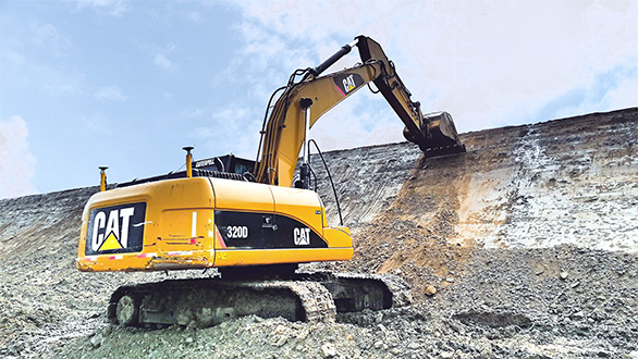
MACHINE CONTROL & CONSTRUCTION

High-productivity GNSS sensors and solutions.

MACHINE CONTROL & CONSTRUCTION

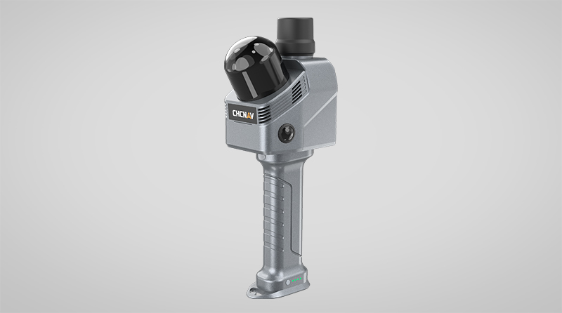
MAPPING & GEOSPATIAL

Mobile mapping solution for 3D mass data acquisition.

MAPPING & GEOSPATIAL

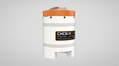
Marine Construction

High-performance USVs, GNSS sensors and echosounders

for marine survey and construction professionals.

Marine Construction

News & Events

The BIG5 Saudi 2021

The BIG5 Saudi is re-scheduled for May 24th- 27th 2021  when we can ensure we continue to deliver globally trusted events in safe and conducive operating conditions.  CHC Navigation and its partner SV EST will still participate in the Big 5 Saudi exhibition when it is ready in Riyadh, Saudi Arabia.  

2021-03-07
2021-05-24 2021-05-27 Riyadh, Saudi Arabia The BIG5 Saudi 2021

OCEANOLOGY INTERNATIONAL 2020

OCEANOLOGY CONNECT will start on 1 to 4 December, which is an online exhibition due to the COVID-19.   With 50 years of expertise, Oceanology International is the world’s largest ocean technology exhibition and conference. With over 8,000 attendees targeted for 2020, it is a must-attend event for those involved in exploring, monitoring, developing or protecting the world’s oceans, from seabed to surface and beyond.   Attracting visitors from a variety of industries, including oil & gas, marine renewables and maritime defence, Oceanology International gives the opportunity for buyers and suppliers to do business in one location. Oceanology International offers structured networking opportunities to help suppliers establish relationships and secure business on a global scale.    

2020-12-01
2020-12-01 2020-12-04 London, United Kingdom OCEANOLOGY INTERNATIONAL 2020

Intergeo 2020

INTERGEO is the world's largest Exhibition and Conference platform for geoinformation, which will take place from 13 to 15 October in Berlin. The exhibition area presents the latest developments in geographical information systems, surveying instruments, navigation technology, data processing, disaster response, municipal planning…   Come meet us at booths C26.61 and C26.58 to learn about CHCNAV latest GNSS and Mobile Mapping technologies and applications.   We look forward to seeing you there!

2020-10-13
2020-10-13 2020-10-15 Berlin, Germany Intergeo 2020

CHCNAV GNSS used in Turkish Research Project

The Research Project   The CHCNAV’s i50 GNSS smart antenna and N72 GNSS reference station have been used by Turkish researchers in their study about the “Analysis of the contribution of multi-GNSS to long-distance RTK.”   The effects of baseline length on GNSS position accuracy   GNSS, as it is commonly referred to, is the acronym for Global Navigation Satellite System, which can provide users with a fast, economical and reliable positioning service with global coverage. With the introduction of the RTK technology, GNSS has become a practical tool for real-time and accurate positioning in many engineering applications. However, the accuracy of GNSS RTK measurements depends on the baseline length between the GNSS reference station and the GNSS rover. With new emerging satellite systems such as GALILEO and BEIDOU, it is possible to explore the potential impact of multi-GNSS on the long baseline RTK accuracy.   An 80 km baseline used for the GNSS RTK research project   A field trial was conducted on an 80 km baseline using different combinations of satellite constellations with the CHCNAV i50 and N72 GNSS* receivers.  Researchers performed two surveys - a one-hour RTK survey and a five-hour static GNSS survey - on the rovers and reference stations respectively. Both the CHCNAV’s i50 and N72 GNSS receivers can record continuous GNSS raw data observations. With the capability to track the signal of all available GNSS systems, they were able to evaluate various satellite constellations mix. The GNSS RTCM corrections were transmitted over the NTRIP protocol (Networked Transport of RTCM via Internet Protocol) with a GSM data link. In practice, CHCNAV provides additional proprietary APIS and standard TCP protocols, using the data controller's Internet access or the internal 4G network data link of the receivers as desired.   Multi-constellations GNSS enables centimeter accuracy at long distances   The tests results demonstrated that an accuracy of +/- 5 cm horizontally and +/- 10 cm vertically can be achieved. Moreover, under open sky conditions, with sufficient numbers of satellites in view, the different mix of GNSS configurations gave almost identical results.   The paper was published on the Intercontinental Geoinformation Days (IGD) in November 2020 and is available for download at https://zcu.io/zgHD    The N72 GNSS reference station is now replaced by the P5E or P2 GNSS receivers.

2021-02-02

How drones are used in marine surveys

A Demonstration of Apache6 USV for the General Directorate of Water Management (OVF) in Hungary   The context of the marine drone demonstration.   On December 8, 2020, the Department of Spatial Data Technical Service organized a one-day workshop in Kis-Balaton, with the participation of the Trans-Danube Water Council. During this event, CHC Navigation and Norbit Hungary (a global provider of multibeam sonars) conducted a demonstration to present the capability of the Apache6 USV for the Directorate General of Water Management (OVF).     How using drones in marine survey can increase productivity?   During the live demonstration, experts from CHC Navigation and Norbit presented the characteristics, operation and results of advanced bathymetric survey measurements with unmanned marine drones. The Apache6 USV is easy to install and operate. Weighing only 15 kg, two operators can handle most remote deployment conditions.   Like an aerial drone, the Apache6 has an auto-return feature and uses sonic radar (sonar) to avoid obstacles. Its fully autonomous survey mode is powered by the absolute straight-line CHCNAV technology, so the vessel follows a predetermined trajectory even under adverse current conditions.   The 2020 Edition of the Apache6 USV (unmanned surface vessel) was launched in May 2020. It combines a dual GNSS positioning and heading sensor, stable and reliable hull attitude and an inertial measurement unit (IMU). CHCNAV's GNSS/INS control unit maintains high accuracy during GNSS transient outages, assuring uninterrupted surveying while passing under bridges.   How using LiDAR scanners can extend the boundaries of marine survey applications?   In addition to 3D bathymetric surveys, marine drones are used for the positioning of underwater objects, construction of ports, offshore installations, underwater archaeology, marine salvage and wreck removal. The CHCNAV Apache USV Series are equipped with high-performance single-beam or multibeam echo sounder and can be complemented with a surface LiDAR to create a combined high-precision marine and terrestrial 3D survey in a single pass, such as for port and river surveys with height clearance evaluation.

2021-01-15

CHCNAV's GNSS receivers contribute to measuring the Everest's peak height

Shanghai, China - December 8, 2020 – CHC Navigation (CHCNAV). China and Nepal jointly announced today that the height of Mount Everest is 8,868.86 meters. This is a historic moment for CHCNAV since our P5 geodetic GNSS receiver successfully contributed to the peak elevation survey. It also demonstrates CHCNAV's technological success as a major player in the GNSS surveying and mapping industry and confirms BeiDou as a major part of the GNSS systems.   Re-measurement is essential because the height of Everest is constantly changing. The most recent example is the Gorkha earthquake of 2015 - most geologists and scientists agree that Mount Everest may have shrunk by about 3 cm and may have moved southward by a meter or more. Apart from this earthquake, the height is also subject to precipitation, wind and global warming. It is estimated that the peak undergoes tectonic uplift of about 1 cm per year. In addition, the height assessment has also changed with technological progress in surveying technology.   The reason why it is difficult to measure the height of Mount Everest is the presence of extreme temperatures and abnormal atmospheric pressure. At more than 8,800 meters above sea level, with extreme temperatures, below -45°C, and a low atmospheric pressure, only 30 kPa (compared to the normal 101 kPa), every movement of the surveyors is significantly difficult because of their protective clothing against the cold and the lack of oxygen. The operation of the equipment must therefore be as efficient as possible.   In this kind of scenario, people experience the physiological challenge of climbing Mount Everest, following the same logic as the GNSS receiver itself. Efforts to achieve the measurement mission must overcome environmental obstacles. The GNSS receivers, provided by CHCNAV, have already passed rigorous testing and have been optimized to ensure the success of the mission. CHCNAV technical team optimized the receivers to adapt to the extremely low temperature. The CHCNAV R&D department redesigned the lithium-ion batteries to provide 12 hours of operation even at low temperatures, changed the antenna cable materials to a composite to avoid any cracking or signal attenuation.   On May 28, 2020, China's National Geodetic Survey Team conducted the 2020 Mount Everest Elevation Survey. 30 of the 60 points of the GNSS control network have been measured with CHCNAV GNSS receivers, including 3 of the 6 points of intersection of the Everest elevation. The CHCNAV P5 GNSS receiver finally reached the summit and successfully completed its assigned mission.   The results of this surveying mission provide an important data support for the Mount Everest peak elevation survey, as well as an additional input for its ecological and environmental protection, geological survey, monitoring of crustal movement, topographic mapping, etc.

2020-12-15

OI CONNECT 2020 December 1-4

Meet us at OI 2020 - December 1-4   Oceanology International is the world’s largest ocean technology exhibition and conference.   CHCNAV will be present at the Oceanology International virtual exhibition from December 1st to 4th. We are pleased to invite you to join us for this exhibition.   During this event, you will be able to get in touch with our experts to discover the most advanced geospatial technologies for marine applications. In addition, CHCNAV is expanding its distribution network for its marine survey range in different countries. Do not hesitate to contact us to discuss the possibilities of cooperation.   Our Apache hydrographic drones and GNSS+INS sensors for marine and engineering operations will be on display. Other geospatial technologies and solutions for land surveying, construction and 3D mobile mapping for mass data acquisition will also be introduced.   Whether you are users, integrators or distributors of advanced marine or hydrographic equipment, come and establish a partnership with us from December 1st to 4th.   Learn more at: https://oi.eventnetworking.com/  

2020-12-04

Intergeo Digital 2020 October 13-15

INTERGEO 2020 will take place from 13 to 15 October as a purely digital event.  CHCNAV will take this opportunity and participate in this virtual event. It is an honor for the CHCNAV to invite you to this online exhibition.   As an exhibitor, CHCNAV will present upcoming solutions for various industries, new products, and webinars on different topics. In addition, we will offer you our support via a digital video chat that you can join at your convenience.  You can also contact us in advance for an individual appointment.   More information about INTERGEO Digital 2020 can be found at: https://www.intergeo.de/en/   Your presence will be a great honour and will definitely make the event more special.

2020-09-29

Industries

  • Surveying & Engineering

    Leveraging decades of expertise, CHCNAV brings you advanced GNSS and optical positioning solutions to make your surveying and engineering projects more productive.

  • Machine Control & Construction

    More than robust GNSS technology, our Machine Control and Construction solutions are engineered to be high-productivity survey tools to complete your projects faster.

  • Mapping & Geospatial

    With renowned expertise in real time precision GNSS, scanners and advanced 3D point cloud algorithms, CHCNAV creates advanced hardware and software solutions for mapping and geospatial mass data acquisition, processing and maintenance.

  • Infrastructure

    The CHCNAV Infrastructure Solutions deliver consistent, reliable and accurate real-time GNSS data to any demanding high accuracy positioning and navigation.

  • Marine Construction

    High-performance USVs, rugged positioning and heading GNSS sensors and echosounders provide complete solutions for marine survey and construction professionals.

  • Precision Agriculture

    Easy to use and easy to own, our tractor full RTK auto-steering systems and GNSS RTK base or network solutions are designed for farmers to make production more efficient.

  • GNSS OEM

    With our engineering expertise and lean manufacturing process, CHCNAV provides custom design GNSS solutions to industrial partners and system integrators.

    chcnav chcnav chcnav

Chcnav At a Glance

CHC Navigation is a publicly-listed company creating Innovative GNSS Navigation and Positioning Solutions.

With a global presence across the world, CHC Navigation is today recognized as one of the fastest-growing companies in Geomatics Technologies.

  • Founded in 2003
  • Worldwide Sales & Customer Support 100+
  • Satisfied Customers 100000+
  • Multinational Global Workforce 1300+
  • R&D Engineers 400+
  • GNSS and Related Patents 300+
e-Newsletter

Subscribe to our Newsletter and stay informed about exciting developments, new products, case studies and exclusive invitations to events.

captcha
I agree to the "Privacy Policy" and "Terms of use"
Please select this field to continue.
chcnav site logo
Contact Us

Phone:  

+86 21 5426 0273


Email:  

marketing@chcnav.com

Industries
  • Surveying & Engineering
  • Machine Control & Construction
  • Mapping & Geospatial
  • Infrastructure
  • Marine Construction
  • Precision Agriculture
  • GNSS OEM
Products
  • Total Stations
  • GNSS Systems
  • Machine Control Solutions
  • Mobile Mapping Systems
  • Marine Systems
  • Agriculture Systems
  • GNSS OEM Systems
Support
  • Support & Training
  • Maintenance & Repair
About Us
  • Overview
  • News & Events
Contact Us
  • Send an Inquiry
  • Become a CHCNAV Partner
  • Find a Dealer
© 2019 Shanghai Huace Navigation Technology Ltd.,All rights reserved.
Terms of Use | Privacy Policy | Cookies Policy
facebook icon linked_in icon youtube icon twitter icon instagram icon