CHC Navigation delivers precision geospatial solutions with advanced mapping systems, unmanned platforms, and GNSS+INS+LiDAR technology for spatial data capture.
CHC Navigation offers advanced GPS/GNSS machine control systems for excavators, dozers, graders, and compactors. Improve accuracy, cut costs, and complete construction projects faster with reliable global support.
CHC Navigation delivers high-precision GNSS + INS navigation systems for autonomous vehicle, automotive, robotics, mining, marine, and industrial applications.
We offer tractor guidance and auto-steering systems for farms of any size, powered by GPS farming technologies. Improve your precision agriculture practices with smart agriculture solutions starting today.
CHCNAV Exhibits at XXVIII FIG Congress 2026 in Cape Town
CHC Navigation (CHCNAV) will exhibit at the XXVIII FIG Congress 2026, taking place 24 - 29 May 2026 in Cape Town, South Africa.
Visit Booth 13 - 16 to discover CHCNAV geospatial technologies designed to improve productivity and data quality across surveying and mapping workflows. Meet the team for product briefings, use case discussions, and live demonstrations of integrated solutions for field data capture and office processing.
FIG Congress is FIG’s flagship global event and will be held in Cape Town under the theme “The Future We Want: The SDGs and Beyond.”
Featured CHCNAV solutions at FIG Congress 2026
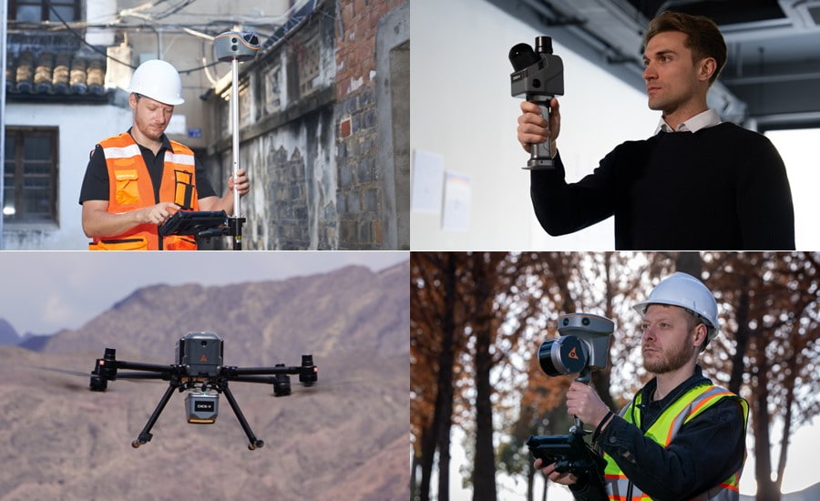
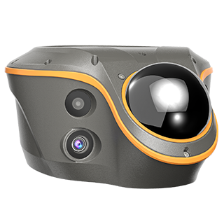
ViLi i100 GNSS + LiDAR receiver: Flagship full-hybrid surveying platform combining advanced GNSS positioning, and LiDAR technology to support reliable centimeter level results even in GNSS-denied environments. Learn More
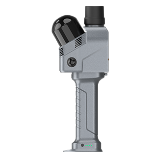
RS7 handheld LiDAR SLAM scanner: Tool grade mobile mapping for buildings and interiors, designed for efficient indoor 3D reality capture and fast deliverables. Learn More
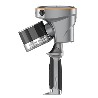
RS10 handheld GNSS RTK + SLAM 3D laser scanner: GNSS RTK, laser scanning, and visual SLAM in a single device for flexible indoor and outdoor 3D capture, including in areas with weak GNSS reception. Learn More
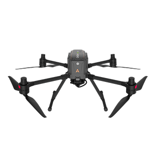
X500 rotor UAV platform: Professional UAV platform designed for demanding field operations and compatible with multiple mapping payload options. Learn More
Plan your visit
CHC Navigation looks forward to meeting surveying and mapping professionals in Cape Town in May 2026. Visit Booth 13 to 16 to discuss your projects and see CHCNAV solutions in action.
About FIG
The International Federation of Surveyors (FIG) is the global organization representing the interests of surveyors and geospatial professionals worldwide. Through its congresses, working groups, and technical commissions, FIG promotes collaboration, knowledge exchange, and innovation across the surveying and geospatial community. For more information about the event, visit the official FIG website. Learn More
____
About CHC Navigation
CHC Navigation (CHCNAV) develops advanced mapping, navigation, and positioning solutions designed to increase productivity and efficiency. Serving industries such as geospatial, agriculture, construction and autonomy, CHCNAV delivers innovative technologies that empower professionals and drive industry advancement. With a global presence spanning over 140 countries and a team of more than 2,000 professionals, CHC Navigation is recognized as a leader in the geospatial industry and beyond. For more information about CHC Navigation [Huace:300627.SZ], please visit: www.chcnav.com
Related Products
CHCNAV ViLi i100
Visual-LiDAR GNSS RTK receiver with consistent accuracy in obstructions