CHC Navigation offers advanced GPS/GNSS machine control systems for excavators, dozers, graders, and compactors. Improve accuracy, cut costs, and complete construction projects faster with reliable global support.
CHC Navigation to Showcase Geospatial and Construction Solutions at CSPI-EXPO 2026
CHC Navigation (CHCNAV), a global provider of geospatial and machine control technologies, announced its participation in the 8th International Construction and Survey Productivity Improvement Expo (CSPI-EXPO 2026), held June 17 to 20, 2026, at Makuhari Messe in Chiba, Japan.
At Booth 12-61, CHC Navigation will present integrated solutions for construction, surveying, mapping, and marine operations. Visitors can meet the CHCNAV team, review application workflows, and see how connected field technologies help improve productivity and data quality across real-world jobsite conditions.
Featured Solutions at CSPI-EXPO 2026
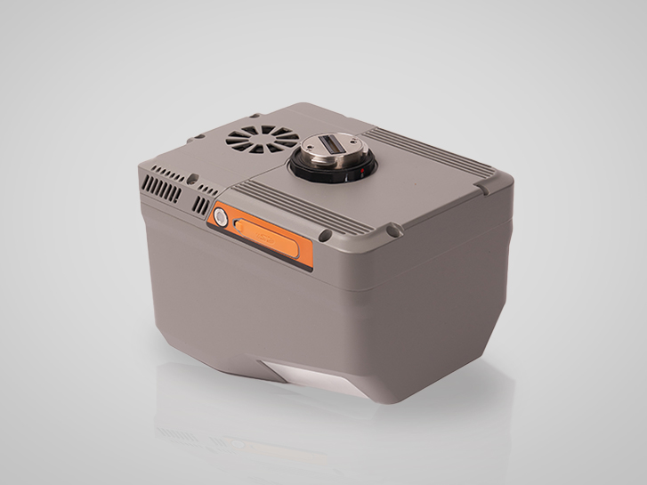
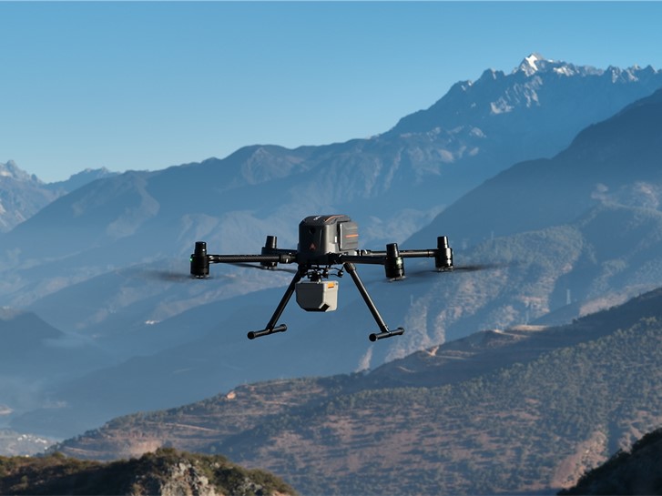
AlphaAir 6 (AA6) Airborne LiDAR System
The CHCNAV AlphaAir 6 (AA6) is designed for efficient aerial surveying in complex and high-relief terrain. It combines prism-based scanning with a high-grade inertial navigation system to support long-range measurements up to 2,100 m and typical operating altitudes of 100 to 600 m AGL. Real-time waveform processing supports improved point cloud density and data completeness, while open interfaces help enable integration with multirotor and fixed-wing UAV platforms.
X500 UAV with AlphaAir 6 performing LiDAR surveying in mountainous terrain.
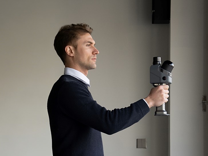
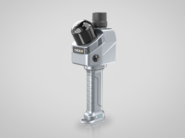
RS7 Handheld LiDAR SLAM Scanner
The CHCNAV RS7 is a tool-grade handheld LiDAR SLAM scanner designed for building and interior applications. By combining high-precision INS and SLAM, it supports stable motion tracking in feature-poor environments. With 1.15 million points per second, a 360° x 189° field of view, HD imaging, 3D Gaussian Splatting (3DGS), and device-to-cloud workflows, RS7 supports efficient reality capture and faster deliverables.
RS7 handheld LiDAR scanner capturing indoor 3D data for project documentation.
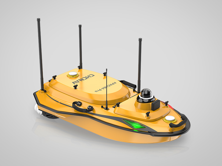
APACHE 4 Pro Unmanned Surface Vessel (USV)
The CHCNAV APACHE 4 Pro is a compact USV platform designed for hydrological survey tasks. It supports integration with mainstream ADCPs and can be configured with the CHCNAV HQ-400 multibeam echo sounder for bathymetric surveys. The platform can also be adapted to carry additional sensors such as water quality meters and side-scan sonar, depending on project requirements.
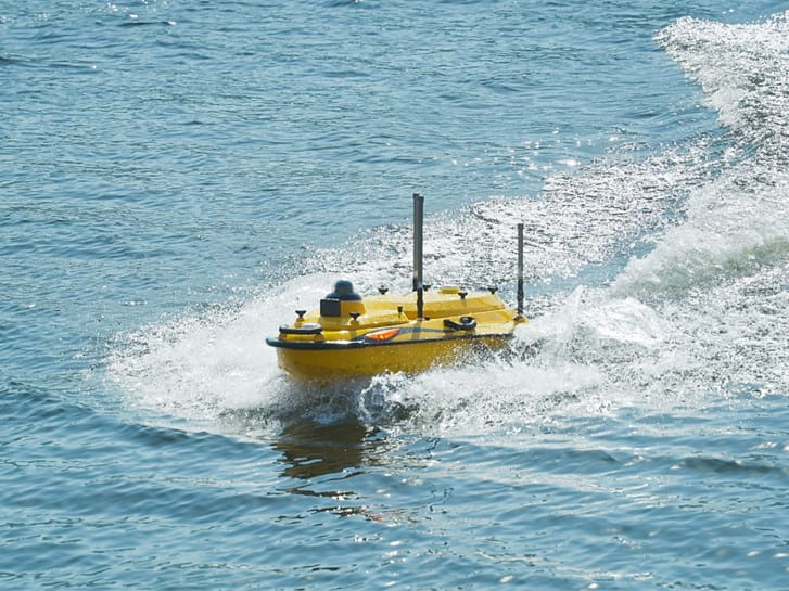
Apache 4 Pro USV conducting bathymetric surveying in the river.
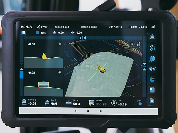
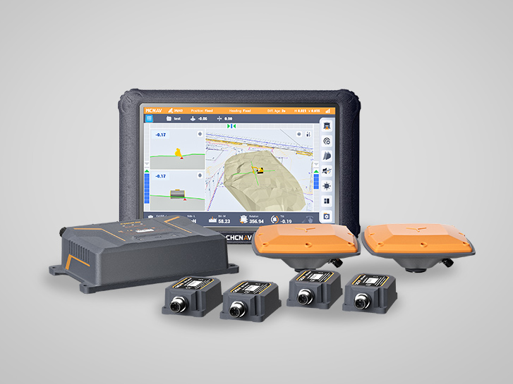
TX73 Machine Control System
The CHCNAV TX73 system supports excavator guidance by providing real-time bucket position relative to digital design models. With a high-precision GNSS receiver and IMU sensors, it helps operators reach target surfaces more efficiently and reduce reliance on staking, supporting improved speed, quality, and repeatability on earthmoving projects.
TX73 machine control system guiding an excavator with real-time positioning data.
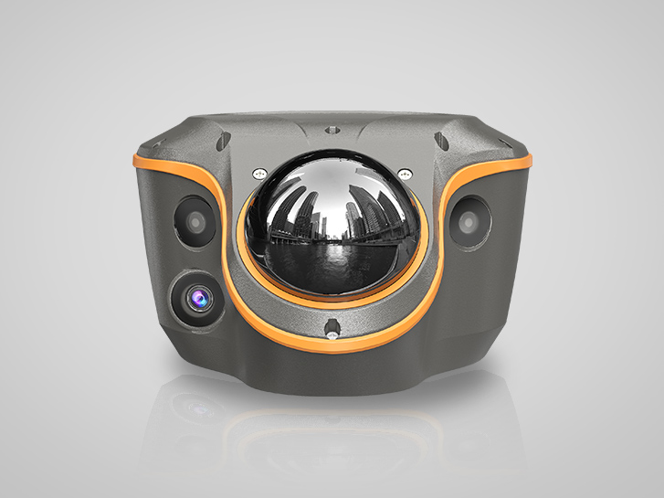
ViLi i100 GNSS Receiver
The CHCNAV ViLi i100 is a flagship GNSS RTK receiver designed for high-precision surveying in challenging environments. With SFix 2.0 positioning, advanced GNSS filtering, and integrated Vi-LiDAR technology, it supports reliable centimeter-level accuracy beyond traditional GNSS limits.
ViLi i100 GNSS RTK receiver used for high-precision surveying in urban environments.
About CSPI-EXPO 2026
CSPI-EXPO is a major exhibition focused on improving productivity in construction and surveying. The 2026 edition will be held June 17 to 20 at Makuhari Messe in Chiba, Japan. Learn more at https://cspi-expo.com/
____
About CHC Navigation
CHC Navigation (CHCNAV) develops advanced mapping, navigation and positioning solutions to increase productivity and efficiency. Serving industries such as geospatial, agriculture, construction and autonomy, CHCNAV empowers professionals with innovative technologies. With operations in over 140 countries and a team of more than 2,200 professionals, CHCNAV is a recognized leader in the geospatial and related industries. Learn more about CHC Navigation at https://www.chcnav.com/about/overview
Schedule Time With Our Team
Planning to attend CSPI-EXPO 2026? Send us an inquiry to arrange a dedicated meeting and explore how our solutions can support your projects.