CHC Navigation offers advanced GPS/GNSS machine control systems for excavators, dozers, graders, and compactors. Improve accuracy, cut costs, and complete construction projects faster with reliable global support.
CHC Navigation Introduces D60 Dual Frequency Single Beam Echo Sounder for USV Bathymetry
2026-04-24
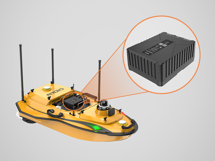
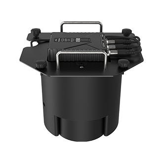
Shanghai, China, April 24, 2026. CHC Navigation (CHCNAV), a global provider of geospatial solutions, announced the release of the D60, a dual-frequency single-beam echo sounder engineered for unmanned surface vessel (USV) operations. Designed for hydrographic survey and bathymetric mapping workflows, the D60 combines an integrated motion compensation IMU with adaptive auto-tuning algorithms to support stable depth sounding in turbid water and in areas with rapid depth transitions.
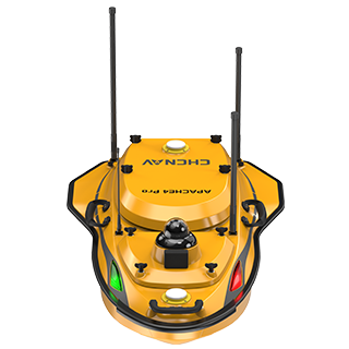
Apache 4 Pro USV equipped with D60 single-beam echo sounder.
Dual-frequency depth measurement for versatile bathymetric surveys
The D60 operates at 200 kHz and 33 kHz to support depth measurement across a wide range of survey conditions. The dual-frequency echo sounder provides a measurement range from 0.2 m to 1,000 m, supporting shallow-water bathymetry as well as deeper-water profiling. This configuration is designed to help maintain dependable signal performance across varied underwater topography, including rivers, reservoirs, estuaries, and nearshore areas.
Motion compensation IMU for stable data on moving USVs
For USV bathymetry, vessel motion can degrade data quality. The D60 integrates an internal attitude sensor sampling at 100 Hz. Its real-time attitude compensation supports roll and pitch correction during data acquisition, helping maintain consistent bathymetric data while the platform is underway.
Adaptive auto-tuning for changing riverbeds and turbid water
The D60 uses intelligent algorithms that monitor incoming echo signals and automatically update operating parameters within 0.2 seconds. Automated gain and range adjustment reduces manual tuning and supports consistent depth measurement when survey conditions change, including abrupt depth shifts and highly turbid waters.
Compact USV payload with streamlined hydrographic workflow
Built as an integrated single-beam echosounder system with a 1.2 kg main unit, the D60 is designed to minimize payload impact on compact USV platforms and support fast installation and removal. When integrated with the CHCNAV EasySail software ecosystem, the D60 supports a one-person hydrographic survey workflow that includes data acquisition, real-time visualization, post-processing, and file export from the remote control.
____
About CHC Navigation
CHC Navigation (CHCNAV) develops advanced mapping, navigation, and positioning solutions designed to increase productivity and efficiency. Serving industries such as geospatial, agriculture, machine control and autonomy, CHCNAV delivers innovative technologies that empower professionals and drive industry advancement. With a global presence spanning over 140 countries and a team of more than 2,200 professionals, CHC Navigation is recognized as a leader in the geospatial industry and beyond. For more information about CHC Navigation [Huace:300627.SZ], please visit: https://www.chcnav.com/about/overview