CHC Navigation delivers precision geospatial solutions with advanced mapping systems, unmanned platforms, and GNSS+INS+LiDAR technology for spatial data capture.
CHC Navigation offers advanced GPS/GNSS machine control systems for excavators, dozers, graders, and compactors. Improve accuracy, cut costs, and complete construction projects faster with reliable global support.
CHC Navigation delivers high-precision GNSS + INS navigation systems for autonomous vehicle, automotive, robotics, mining, marine, and industrial applications.
We offer tractor guidance and auto-steering systems for farms of any size, powered by GPS farming technologies. Improve your precision agriculture practices with smart agriculture solutions starting today.
CHCNAV Updates i85 Laser IMU RTK GNSS Receiver with 150 m Laser Measurement Capability and PointSky Support
2026-06-18
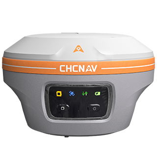
Shanghai, China, June 18, 2026. CHC Navigation (CHCNAV), a global provider of geospatial solutions, announced a major update to the CHCNAV i85, a compact laser IMU RTK GNSS receiver designed for efficient daily land surveying. The updated i85 extends its laser measurement capability up to 150 m under favorable conditions and adds compatibility with CHCNAV PointSky L-band GNSS correction services, helping surveyors capture remote points and work more efficiently in areas where network RTK access is limited or unavailable.
Surveyor using CHCNAV i85 RTK GNSS receiver for transportation infrastructure measurement.
150 m laser measurement for inaccessible point collection
The updated i85 features a visible green laser with a measurement range of up to 150 m under favorable conditions. The laser is designed to remain visible in bright outdoor conditions, and resist ambient light levels of up to 50,000 lux. By combining GNSS positioning and laser ranging, the i85 enables survey-grade 3D coordinate collection without requiring direct physical access to every point. Surveyors can measure building corners, road edges, fences, utility assets, slopes, embankments, and other hard-to-reach features from safer or more convenient positions.
IMU RTK GNSS workflow for faster field surveying
The i85 integrates high-precision IMU tilt compensation to help users collect points without keeping the pole perfectly vertical. In high-accuracy laser survey mode, the receiver supports 3 cm measurement accuracy at a 10 m distance, helping maintain reliable results when capturing remote offset points. This laser IMU RTK GNSS workflow reduces repeated receiver repositioning and helps improve productivity in complex field conditions. It is particularly useful where physical access is limited by traffic, vegetation, water, steep terrain, construction activity, or safety restrictions.
PointSky satellite corrections for remote survey sites
The updated i85 adds compatibility with CHCNAV PointSky L-band GNSS correction services. PointSky delivers real-time centimeter-level GNSS corrections via satellite, reducing dependence on a local base station, radio link, or NTRIP network service. This capability supports field teams working in remote locations where cellular coverage is limited, unstable, or unavailable. For topographic and remote infrastructure surveys, PointSky helps simplify field logistics by allowing surveyors to work with fewer setup requirements in the field.
____
About CHC Navigation
CHC Navigation (CHCNAV) develops advanced mapping, navigation, and positioning solutions designed to increase productivity and efficiency. Serving industries such as geospatial, agriculture, machine control, and autonomy, CHCNAV delivers innovative technologies that empower professionals and drive industry advancement. With a global presence spanning over 140 countries and a team of more than 2,200 professionals, CHC Navigation is recognized as a leader in the geospatial industry and beyond. For more information about CHC Navigation [Huace:300627.SZ], please visit: https://www.chcnav.com/about/overview