CHC Navigation offers advanced GPS/GNSS machine control systems for excavators, dozers, graders, and compactors. Improve accuracy, cut costs, and complete construction projects faster with reliable global support.
Making High-Precision Technology More Accessible for Real-World Field Operations
18 Nov 2026
High-precision positioning and geospatial technologies are now used across surveying, construction, infrastructure, agriculture, marine operations, environmental monitoring, and mapping. Their value, however, depends on whether organizations can deploy them efficiently in real working environments, not only on the specifications shown in a datasheet.
Field professionals work through changing weather, difficult terrain, limited connectivity, evolving project requirements, and tight schedules. Making high-precision technology more accessible therefore means reducing adoption friction across deployment, training, integration, support, and everyday operation while preserving the accuracy and quality controls required for professional work.
Practical Technology Delivers Greater Operational Value
Every field environment presents different operational challenges. Surveyors often work against tight project deadlines while coordinating with engineers and contractors. Construction teams must adapt quickly to changing site conditions. Agricultural operators require reliable guidance throughout long working days, while marine professionals frequently operate in remote areas where communications may be limited. Under these conditions, technology should support the way professionals already work rather than introducing unnecessary complexity.
Efficient field solutions simplify data collection, guide users through essential workflows, provide clear system status, and help identify potential issues before they affect project outcomes. They also reduce the time required to move from field measurements to usable deliverables, allowing organizations to respond more quickly to changing project requirements. Practicality has therefore become an important measure of technology performance. A solution that consistently supports efficient workflows often creates greater long-term value than one that simply offers the highest technical specifications.
Understanding the Barriers to Technology Adoption
Many organizations recognize the benefits of digital field technology but face practical barriers when introducing new workflows. Purchase cost is only one consideration. Implementation also depends on training, workflow changes, software compatibility, data transfer, technical support, and the time required before users can work productively. Existing processes may need to change, and field and office teams must understand how new data flows into engineering, GIS, machine control, asset management, or cloud platforms.
Workforce development is equally important: technology that shortens the learning curve and standardizes routine procedures can help organizations scale expertise across teams without lowering professional standards. Ultimately, successful adoption depends on confidence. Users are more likely to embrace new technology when they clearly understand how it will improve productivity, reduce rework, enhance data quality, or simplify everyday operations.
Usability Is an Advantage, Not Just a Feature
Ease of use is often viewed as a product characteristic, but in professional field operations it directly influences efficiency, consistency, and return on investment. Clear interfaces reduce the time required for training. Guided workflows help users avoid common mistakes, while integrated quality checks provide confidence that measurements meet project requirements before leaving the site. Importantly, improving usability does not mean reducing professional capability. Surveying and geospatial applications continue to require careful quality control, appropriate coordinate management, and technical expertise. Effective technology simply removes unnecessary complexity so professionals can focus on producing reliable results instead of managing equipment.
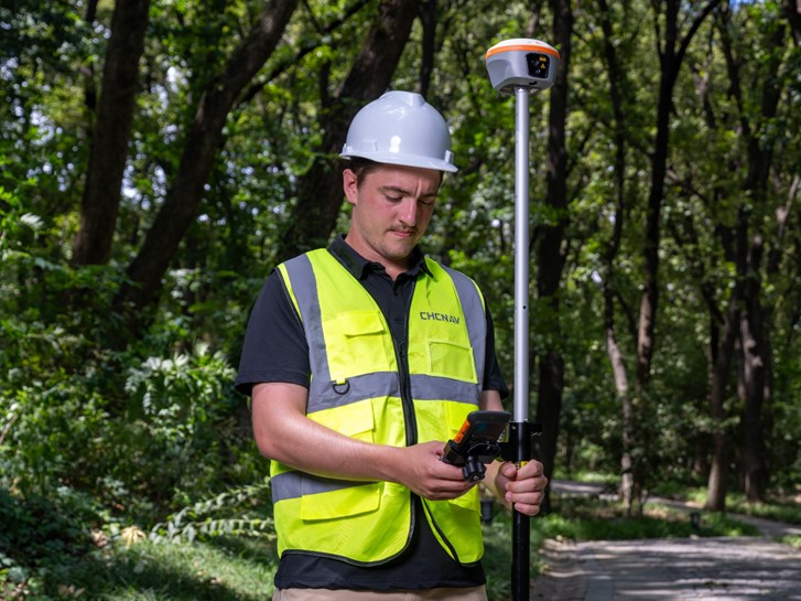
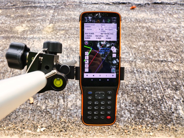
The LandStar data collection software supports this approach with an integrated field environment for high-precision surveying and mapping. Its workflows cover construction surveying, control measurements, CAD-based fieldwork, and stakeout of points, lines, and surfaces, helping teams reduce avoidable setup and data-handling steps while retaining professional control.
Left: Surveyor using CHCNAV i85 GNSS receiver and HCE600 controller with LandStar 8 software in the field. Right: Close-up of CHCNAV HCE600 field controller displaying LandStar 8 surveying software.
Connected Workflows Are Replacing Standalone Devices
The geospatial industry is moving beyond individual instruments toward connected workflows that link data collection, processing, analysis, and project delivery. Today's professionals increasingly work with integrated combinations of GNSS receivers, field controllers, mobile mapping systems, UAV payloads, machine control technologies, and cloud-based software platforms. Rather than functioning as isolated devices, these technologies contribute to a continuous flow of spatial information throughout the project lifecycle.
This evolution helps reduce duplicate work while improving collaboration between field crews, office teams, and project managers. Data collected once can support multiple downstream applications, creating greater value from every field operation. As organizations expand their digital capabilities, connected workflows become an important foundation for improving both operational efficiency and long-term scalability.
Accessibility Supports Growth Across Industries
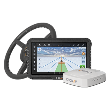
The need for accessible technology extends well beyond traditional surveying applications. In precision agriculture, operators depend on automated guidance systems that can be deployed quickly and used consistently throughout seasonal operations. Ease of setup, repeatable performance, and operator confidence are just as important as positioning accuracy. The CHCNAV NX612 illustrates this principle by supporting precision steering workflows that integrate advanced positioning with practical daily field operations. Similar expectations apply across construction, mapping, marine surveying, and infrastructure management, where technology must fit naturally within established operational processes.
Consistent Workflows Improve Productivity
Productivity is measured by more than the speed of data collection. Organizations also require confidence that information remains accurate, complete, and consistent regardless of who collects it or where the work takes place. Standardized workflows help achieve this consistency by reducing variation between operators, project teams, and regional offices. Common processes simplify training, improve quality assurance, and make it easier to scale operations as organizations grow.
For managers, this consistency improves planning and resource allocation. For project teams, it increases confidence in field data. For customers, it contributes to more reliable project delivery and stronger long-term relationships. Technology that supports repeatable workflows therefore creates value well beyond individual productivity gains.
Supporting the Transition to Connected Organizations
Digital transformation rarely occurs all at once. Many organizations begin by adopting new technology within a single team or project before expanding those capabilities across additional departments or regions. A survey crew may introduce GNSS positioning to improve productivity. A contractor may deploy machine control on selected equipment. A mapping team may begin using 3D reality capture technologies to enhance project documentation.
Over time, these individual solutions become connected through shared software platforms, standardized workflows, and integrated data management practices. Successful technology adoption therefore requires solutions that support current operational needs while remaining flexible enough to accommodate future growth. This ability to scale is an important aspect of accessibility. Organizations benefit most from technology that evolves alongside their digital transformation rather than requiring entirely new workflows as operational requirements change.
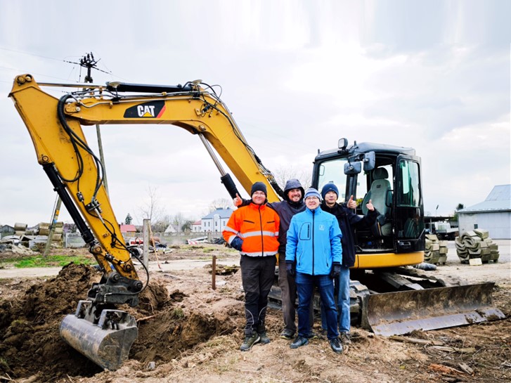
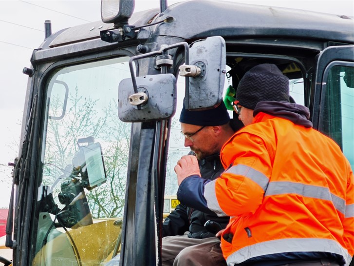
CHCNAV EasyNAV EMG 100 machine guidance system installation for a customer in Poland.
Training and Support Strengthen Technology Adoption
Technology implementation continues well beyond equipment deployment. Training, documentation, technical support, and local service all contribute to the successful adoption of professional geospatial solutions. Organizations need confidence that users can develop the necessary skills while receiving timely assistance whenever technical questions arise. For companies operating internationally, these requirements become even more important. Different regions, industries, regulatory environments, and project types require support that reflects local operating conditions while maintaining consistent technology standards. A strong support ecosystem helps organizations realize the full value of their technology investments by encouraging confident adoption and long-term operational success.
CHC Navigation's Approach to Accessible Innovation
CHC Navigation develops positioning, mapping, navigation, sensing, and software technologies with a strong emphasis on practical usability alongside technical performance. High-precision technology creates lasting value when it is accessible, practical, and easy to integrate into everyday workflows. As organizations continue to modernize surveying, construction, agriculture, infrastructure, and mapping operations, success will depend not only on measurement accuracy but also on how efficiently technology supports the people using it.
By focusing on usability, connected workflows, scalable solutions, and comprehensive customer support, CHC Navigation is helping professionals apply advanced geospatial technologies with greater confidence, enabling more productive field operations and supporting the next generation of intelligent, data-driven industries.
____
About CHC Navigation
CHC Navigation (CHCNAV) develops advanced mapping, navigation, and positioning solutions designed to increase productivity and efficiency. Serving industries such as geospatial, agriculture, machine control, and autonomy, CHCNAV delivers innovative technologies that empower professionals and drive industry advancement. With a global presence spanning over 140 countries and a team of more than 2,200 professionals, CHC Navigation is recognized as a leader in the geospatial industry and beyond. For more information about CHC Navigation [300627.SZ], please visit: https://www.chcnav.com/about/overview
Have a question about our positioning and mapping technologies?