CHC Navigation offers advanced GPS/GNSS machine control systems for excavators, dozers, graders, and compactors. Improve accuracy, cut costs, and complete construction projects faster with reliable global support.
We offer tractor guidance and auto-steering systems for farms of any size, powered by GPS farming technologies. Improve your precision agriculture practices with smart agriculture solutions starting today.
CHC Navigation Contributes to FIG 2026 as a Diamond Sponsor, Advancing Accessible Geospatial Innovation
2026-06-02
Cape Town, South Africa – May 2026 –CHC Navigation (CHCNAV) is a Diamond Sponsor, actively contributing to FIG 2026 by supporting the global surveying and geospatial community in advancing the theme “The Future We Want – The SDGs and Beyond.” The congress brings together industry leaders and professionals to explore how geospatial innovation can drive sustainable development and resilience.
At the event, CHC Navigation is showcasing its latest geospatial solutions and engaging with visitors, partners, and industry experts through on-site demonstrations, technical discussions, and knowledge exchange. The company’s presence highlights its commitment to delivering accessible and integrated technologies that support data-driven decision-making across land and marine environments.
Engaging the Industry Through On-Site Experience
Throughout the exhibition, CHC Navigation’s booth serves as a dynamic hub for hands-on experience and direct interaction. Visitors are invited to explore integrated surveying workflows, observe live demonstrations, and gain insights into how advanced technologies are applied in real operational scenarios.
These on-site activities foster open dialogue and enable meaningful exchanges between CHC Navigation experts and industry professionals. By creating an interactive environment, CHC Navigation not only showcases its technology portfolio but also strengthens collaboration with partners and users, reinforcing its role as an active contributor to the global geospatial ecosystem.
CHC Navigation booth at FIG 2026 exhibition in Cape Town.
Advancing Integrated Surveying Workflows Across Land and Marine Environments
At FIG 2026, CHC Navigation demonstrates how the convergence of GNSS, LiDAR, SLAM, and AR/VR technologies enables more efficient and accessible 3D data capture through unified, cloud-enabled workflows.
At the same time, CHC Navigation presents its capabilities in marine surveying, promoting integrated hydrographic workflows that combine echo sounding, ADCP, GNSS positioning, and uncrewed surface vessels (USVs), improving safety and data quality in complex environments.
Together, these solutions are showcased through real-world use cases and demonstrations, illustrating how integrated workflows reduce complexity and expand access to high-precision geospatial technologies across a wide range of applications.
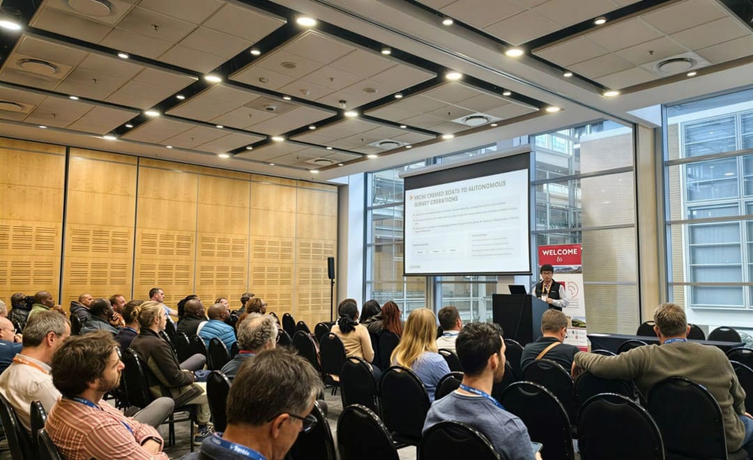
CHC Navigation team presentation at FIG 2026 in Cape Town.
Enabling the Future of Surveying
FIG 2026 highlights the shift from standalone tools to connected, intelligent workflows. CHC Navigation’s participation reflects this transformation by helping professionals improve efficiency, streamline operations, and unlock greater value from geospatial data.
By combining innovation with practical applications and focusing on usability, scalability, and interoperability, CHC Navigation continues to support professionals in adopting more efficient and collaborative workflows, while contributing to a more sustainable and connected future.
____
About CHC Navigation
CHC Navigation (CHCNAV) develops advanced mapping, navigation, and positioning solutions designed to increase productivity and efficiency. Serving industries such as geospatial, agriculture, machine control, and autonomy, CHCNAV delivers innovative technologies that empower professionals and drive industry advancement. With a global presence spanning over 140 countries and a team of more than 2,200 professionals, CHC Navigation is recognized as a leader in the geospatial industry and beyond. For more information about CHC Navigation [Huace:300627.SZ], please visit: https://www.chcnav.com/about/overview
Have a question about our solutions or dealership opportunities?