CHC Navigation offers advanced GPS/GNSS machine control systems for excavators, dozers, graders, and compactors. Improve accuracy, cut costs, and complete construction projects faster with reliable global support.
CHCNAV Unveils Next Generation CoProcess for Point Cloud Processing
2026-05-26
Shanghai, China – May 26, 2026. CHC Navigation (CHCNAV), a global provider of geospatial technologies, has announced the launch of the next generation of CoProcess. This latest release marks a significant evolution of CHCNAV’s professional software, specifically re-engineered to transform extensive LiDAR datasets into structured, engineering-ready deliverables.
Building on the foundation of its predecessor, the new CoProcess provides a unified environment that integrates AI-driven classification, terrain modeling, and scan-to-CAD drafting. The software is designed to further streamline the transition from raw field data to final survey outputs, reducing the complexity of professional mapping workflows.
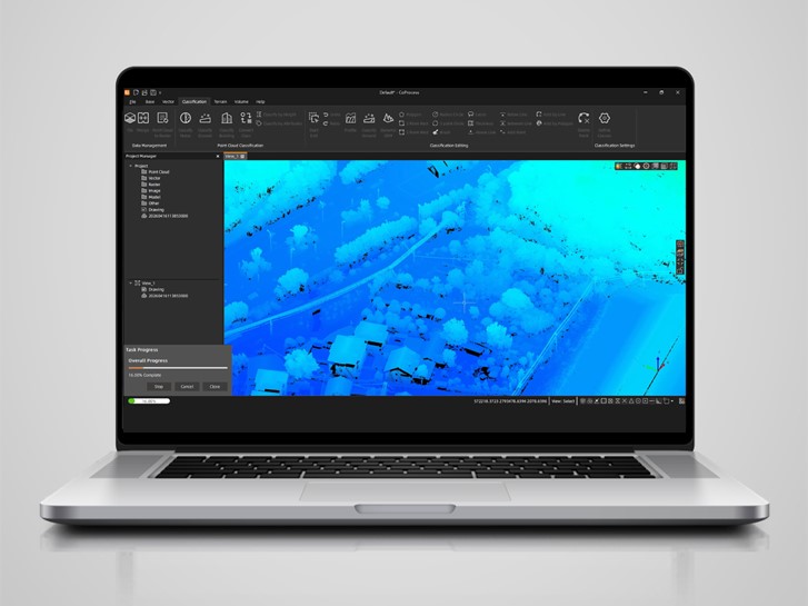
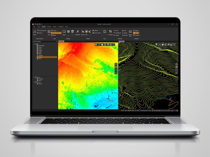
CHCNAV CoProcess software interface for AI-driven point cloud processing, scan-to-CAD drafting, terrain modeling, and LiDAR data workflows.
Advanced Handling of Large-Scale Datasets
To meet the increasing demands of modern geospatial projects, the next-generation CoProcess has been optimized to manage point cloud datasets exceeding 300 GB within a single, continuous workflow. The platform supports the stable rendering of billions of points, allowing users to maintain full data resolution without the need for thinning or segmentation. Efficiency is a core focus of this update. For example, the software’s optimized algorithms can complete terrain classification for a 100 GB dataset in approximately two hours, significantly accelerating project delivery times.
Integrated Survey and CAD Capabilities
CoProcess consolidates the production of survey deliverables by offering an end-to-end toolset that minimizes the need for multiple software applications. Users can generate 2D and 3D CAD models directly from point clouds using refined drafting tools. The platform’s automated classification features facilitate the preparation of structured data, while its terrain surveying module produces high-quality DEMs, DSMs, and contour lines. Additionally, the software enables precise volume calculations for earthworks and stockpiles, including multi-temporal analysis to track changes over time.
Simplified Workflows
The next generation of CoProcess introduces end-to-end workflows that transition from raw data import to final survey outputs within a single environment, reducing dependency on multiple software tools. The platform incorporates standardized processing templates and automation to minimize manual intervention, ensuring greater consistency and reliability across projects. This streamlined approach is supported by intelligent features such as on-the-fly slicing for real-time section views and a fully DWG-native environment, allowing professionals to focus on extraction and design tasks with enhanced productivity.
____
About CHC Navigation
CHC Navigation (CHCNAV) develops advanced mapping, navigation, and positioning solutions designed to increase productivity and efficiency. Serving industries such as geospatial, agriculture, machine control and autonomy, CHCNAV delivers innovative technologies that empower professionals and drive industry advancement. With a global presence spanning over 140 countries and a team of more than 2,200 professionals, CHC Navigation is recognized as a leader in the geospatial industry and beyond. For more information about CHC Navigation [Huace:300627.SZ], please visit: https://www.chcnav.com/about/overview
Related Products
CHCNAV CoProcess
Point Cloud Processing Software for Scan-to-CAD and Terrain Modeling