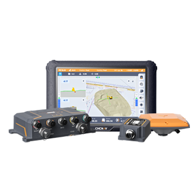
CHC Navigation offers advanced GPS/GNSS machine control systems for excavators, dozers, graders, and compactors. Improve accuracy, cut costs, and complete construction projects faster with reliable global support.
Geospatial AI and the Future of Mapping Technology
31 Aug 2026
Mapping technology has spent the last decade getting very good at collecting data. A single day of fieldwork can now produce a point cloud with hundreds of millions of points, a set of oriented images covering a whole corridor, and a positioning record accurate to a few centimetres. The collection problem is largely solved. What has not kept pace is everything that happens next: deciding which points are ground and which are vegetation, finding the kerb line, checking whether the survey actually met tolerance, and turning all of it into something a designer or an asset manager can use. That gap is where geospatial AI is being applied, and it is quietly changing what mapping technology means in practice.
Geospatial AI is a broad term, and it is worth being precise about it. In a surveying and mapping context it usually refers to machine learning models trained to recognise patterns in spatial data: classifying a point cloud, extracting features from imagery, flagging measurements that look wrong. It is not a replacement for measurement. The model still needs data that is correctly positioned, correctly scaled and correctly timed, and it inherits every error in that data. Understanding where the intelligence helps, and where accuracy still has to come from the sensor, is the useful distinction.
What Geospatial AI Does in a Mapping Workflow
The clearest gains so far are in classification and extraction, the parts of the workflow that used to be measured in operator days. Point cloud classification is the obvious example. Separating ground from vegetation, buildings, poles and wires was once a manual or semi-automatic job that a surveyor completed section by section. Models trained on large volumes of classified data now handle much of that pass automatically, leaving the operator to review and correct rather than to start from nothing.
Feature extraction follows the same pattern. Road markings, kerbs, signs, manholes and facade lines can be identified in imagery or point clouds and turned into vectors without each one being digitised by hand. In corridor mapping, where the same feature types repeat over many kilometres, that is where most of the office time used to go.
Quality control is the third area, and arguably the most interesting for surveyors, because it works in the opposite direction. Instead of producing output faster, it examines the data and points at what looks wrong: a scan region with thin coverage, a trajectory section where the positioning solution degraded, points that disagree with their neighbours by more than the job tolerance. Catching that while the crew is still on site is worth considerably more than catching it a week later.
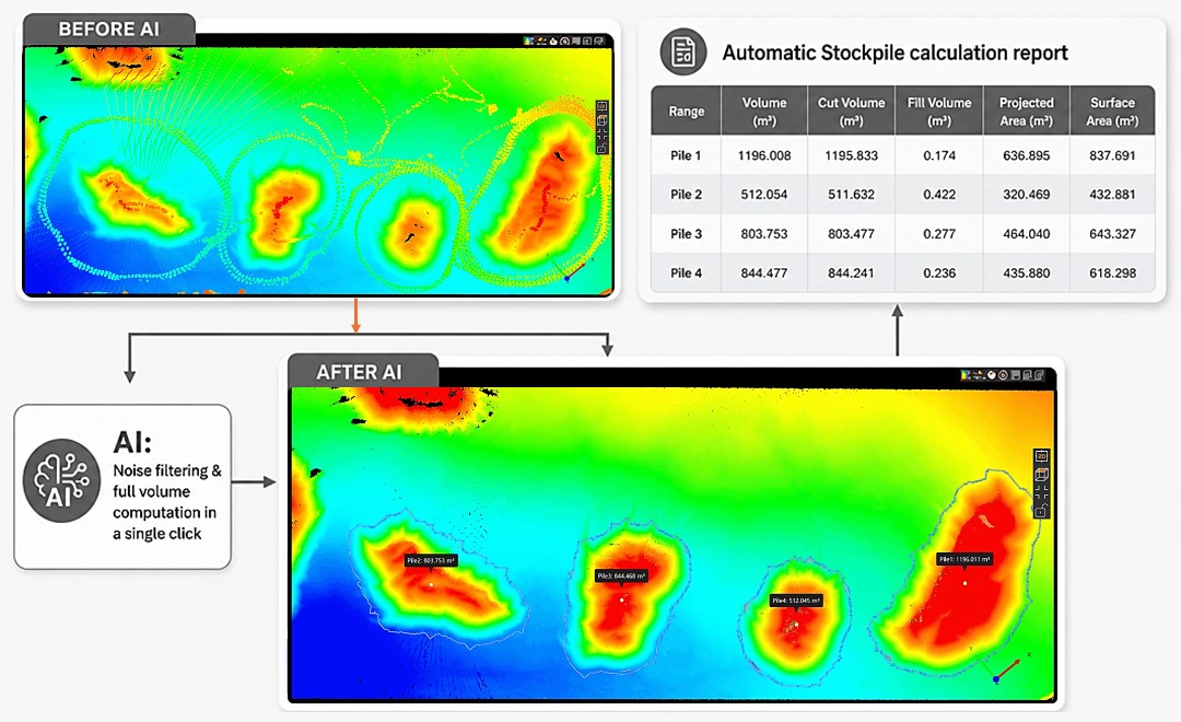
Volume calculation is another practical application, particularly in surveying and earthworks. AI-assisted processing can identify and model stockpile surfaces from point-cloud data, allowing volumes to be calculated with far less manual intervention.
AI-assisted stockpile volume calculation in CHCNAV CoProcess software, illustrating how geospatial AI can turn point-cloud data into measurable survey deliverables.
Why Mapping Technology Arrived Here
None of this is a sudden change. It follows from a shift in how survey data is collected. Reality capture, meaning the practice of recording a whole scene rather than a chosen set of points, has become normal work rather than a specialist service. A handheld scanner walking a tunnel, a unit on a vehicle recording a road at driving speed, a drone flying a corridor: all of them produce complete scenes instead of selected measurements.
That change is what made the office the bottleneck. When a survey consisted of a few hundred deliberately chosen points, processing was straightforward. When it consists of a complete record of everything within range, someone has to decide what all of it represents. Automated interpretation is the natural response to that volume, and it is why mapping technology conversations have moved from sensors towards software.
CHC Navigation has been building towards this from the data side. Integrated hardware and software workflows across GNSS, IMU, vision and LiDAR are designed so that positioning, imagery and point clouds arrive already aligned and time-stamped, which is the condition any automated interpretation depends on. You can read more about how those pieces fit together in CHC Navigation and the next phase of geospatial technology.
The Part That Does Not Change: Positioning
It is easy to read AI progress as a sign that the underlying measurement matters less. In geospatial work the opposite is closer to the truth. A classification model can tell you that a set of points is a kerb. It cannot tell you where that kerb is. Position comes from GNSS, from inertial measurement, and from the way those are fused into a trajectory, and any error there propagates through everything the model produces afterwards.
This is why the accuracy questions have not gone away. Multipath in an urban canyon, a short GNSS interruption under a bridge, a correction service that drops for thirty seconds: each one puts a small distortion into the trajectory, and a distorted trajectory produces a confidently mislabelled point cloud rather than an obviously broken one. Automated interpretation can make a positioning problem harder to see, because the output still looks tidy. Reliable GNSS, sound inertial fusion and honest quality reporting matter more in an automated workflow, not less.
What This Means for Surveying Technology in the Field
For the surveyor, the practical effect is a change in where the work sits. Field time is increasingly about coverage and confidence: capturing the scene completely, and knowing while still on site whether the data will hold up. Office time shifts from producing deliverables to reviewing and correcting them. The skill that gains value is judgement about data quality, because someone still has to decide whether an automated result is right.
It also changes what to ask of equipment. If interpretation is going to be automated, then the data handed to it has to be well conditioned: consistent point density, reliable time synchronisation between sensors, a trajectory with a documented accuracy record, and formats that move into standard software without conversion losses. A system that produces a beautiful point cloud but no dependable record of how it was positioned is harder to automate around, not easier.
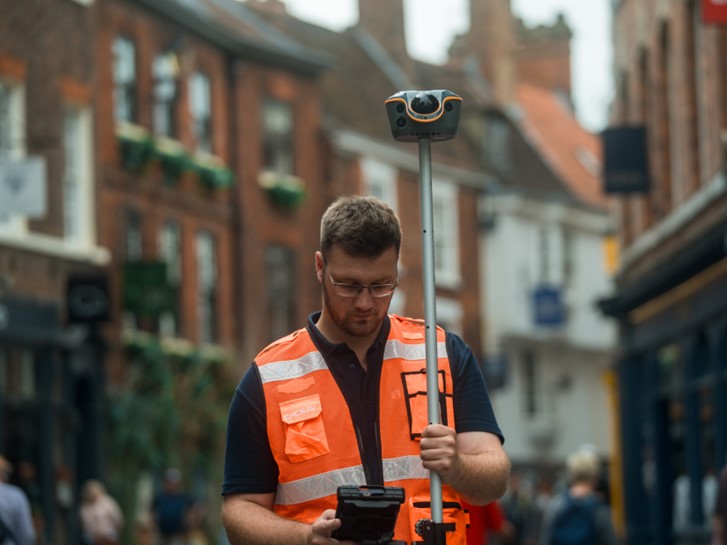
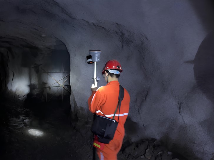
Left: Fast, contactless capture of street surroundings using the CHCNAV ViLi i100, combining GNSS RTK positioning with Vi-LiDAR technology. Right: Underground mine tunnel inspection using the CHCNAV RS10 handheld SLAM 3D laser scanner.
What to Look for as Geospatial AI Matures
Two things are worth watching. The first is transparency. An automated classification that comes with a confidence measure, and a clear way to see which areas the model was unsure about, is far more useful in professional work than one that simply returns an answer. Surveying carries liability, and a result that cannot be checked is difficult to sign off.
The second is where the processing happens. Some tasks suit the field, giving the crew an immediate check on coverage and quality before they leave. Others suit the office or the cloud, where full processing power is available. The workflows that hold up tend to split the two deliberately rather than pushing everything to one end.
Geospatial AI is not replacing surveying technology. It is removing a category of repetitive interpretation work that was never the valuable part, and in doing so it is raising the value of the two things that remain hard: capturing a complete scene, and knowing how accurate it is. For an industry that has spent years building better sensors, that is a reasonable place for the next phase to begin.
To see how CHC Navigation approaches positioning, reality capture and mapping workflows across surveying, construction, agriculture and autonomy, visit our geospatial technology pages.
____
About CHC Navigation
CHC Navigation (CHCNAV) develops advanced mapping, navigation, and positioning solutions designed to increase productivity and efficiency. Serving industries such as geospatial, agriculture, machine control, and autonomy, CHCNAV delivers innovative technologies that empower professionals and drive industry advancement. With a global presence spanning over 140 countries and a team of more than 2,200 professionals, CHC Navigation is recognized as a leader in the geospatial industry and beyond. For more information about CHC Navigation [300627.SZ], please visit: https://www.chcnav.com/about/overview
Have a question about our solutions or dealership opportunities?