CHC Navigation offers advanced GPS/GNSS machine control systems for excavators, dozers, graders, and compactors. Improve accuracy, cut costs, and complete construction projects faster with reliable global support.
We offer tractor guidance and auto-steering systems for farms of any size, powered by GPS farming technologies. Improve your precision agriculture practices with smart agriculture solutions starting today.
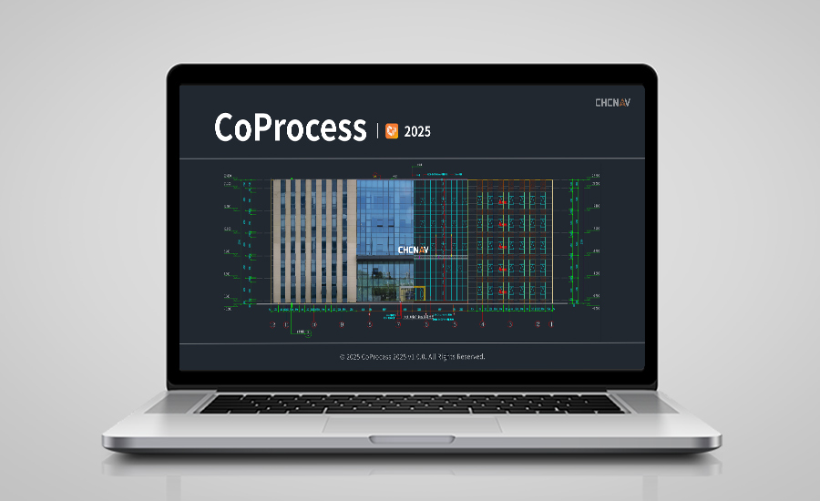
CHC Navigation Launches CoProcess 2025: Integrated Point Cloud and CAD Platform for Efficient Mapping Workflows
2025-09-03
Shanghai, China – September 3, 2025 – CHC Navigation (CHCNAV), a global provider of geospatial solutions, has announced the release of CoProcess 2025, an advanced software platform designed to handle high-volume point cloud datasets while providing built‑in CAD drafting capabilities. CoProcess 2025 offers surveyors, engineers, and mapping professionals a single environment to manage data processing, extraction, and design tasks, helping streamline project delivery from field to final output.
Efficient Processing of Large-Scale Datasets
CoProcess 2025 is engineered to address the primary challenge of working with massive point clouds. The platform can process datasets exceeding 100 GB in a single session, eliminating the need for data segmentation or batching. It is optimized for efficient memory management, allowing systems with 16 GB of RAM to load and navigate 50 GB point clouds without data thinning. This capability ensures that users can work with complete, high-density data, improving the context and accuracy of their projects.
Intelligent Features for Enhanced Accuracy and Visualization
The software provides a complete CAD environment, removing the need to switch between different applications. CoProcess 2025 is fully DWG-native, allowing users to import existing templates and draft directly on standard CAD layers. The workflow is further accelerated with features like on-the-fly slicing, which provides real-time section views for drafting floor plans and elevations. Tools for automated dimensioning, annotations, and one-step contouring simplify complex tasks and enable the direct generation of final deliverables.
____
About CHC Navigation
CHC Navigation (CHCNAV) develops advanced mapping, navigation and positioning solutions designed to increase productivity and efficiency. Serving industries such as geospatial, agriculture, construction and autonomy, CHCNAV delivers innovative technologies that empower professionals and drive industry advancement. With a global presence spanning over 140 countries and a team of more than 2,000 professionals, CHC Navigation is recognized as a leader in the geospatial industry and beyond. For more information about CHC Navigation [Huace:300627.SZ], please visit: www.chcnav.com
CHCNAV CoProcess
Point Cloud Processing Software for Scan-to-CAD and Terrain Modeling