CHC Navigation offers advanced GPS/GNSS machine control systems for excavators, dozers, graders, and compactors. Improve accuracy, cut costs, and complete construction projects faster with reliable global support.
We offer tractor guidance and auto-steering systems for farms of any size, powered by GPS farming technologies. Improve your precision agriculture practices with smart agriculture solutions starting today.
Precision Without Limits: CHCNAV's ViLi i100 GNSS+Vision+LiDAR Redefines GNSS Surveying
2025-12-05
Over the past two decades, GNSS technology has transformed how we survey the world, delivering centimeter-level accuracy in open environments. But in real-world conditions like urban canyons, dense vegetation, or narrow alleys, traditional receivers often fall short. CHC Navigation's new ViLi i100 Vision-LiDAR GNSS RTK Receiver addresses these limitations. By fusing GNSS, LiDAR, multi-camera vision, and a high-frequency IMU, it delivers high-precision positioning even where satellite signals are weak or unavailable, redefining what is possible in reliable field surveying.
The Limitations and Pain Points of Traditional GNSS Surveying
For decades, Global Navigation Satellite System (GNSS) has been the foundation of precision mapping, offering centimeter-level accuracy under open skies. However, real-world environments are rarely ideal. Urban canyons, dense tree cover, and narrow passageways create signal obstructions and multipath interference, leading to jumps in position, degraded accuracy, and the loss of fixed solutions. As a result, surveyors often resort to repeated measurements or switch to slower alternatives like total stations.
Previous efforts to address these challenges have provided only partial relief. IMU-based tilt compensation and advanced signal filtering improved usability but did not overcome the root issue of complete signal loss in obstructed areas. Technologies like photogrammetry and laser ranging served niche scenarios yet often operated in disconnected workflows.The industry has long needed a breakthrough: a GNSS system that can maintain survey-grade precision even when satellite visibility is compromised.
Standard GNSS Receiver Cannot Achieve the Desired Accuracy in Such Environment
Introducing the ViLi i100 - Surveying the Previously Unsurveyable
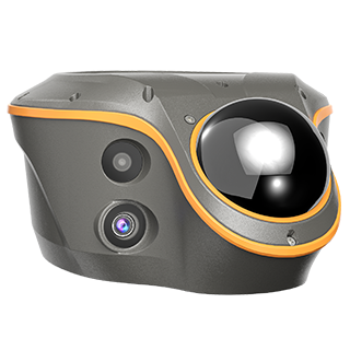
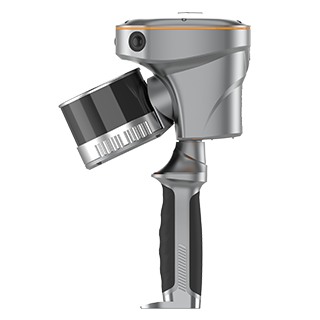
The CHCNAV ViLi i100 is more than a GNSS receiver. It is a fully integrated Visual-LiDAR GNSS RTK system that represents a new standard in high-precision positioning. Built around the advanced SFix 2.0 engine, it goes far beyond the capabilities of earlier technologies. By intelligently combining GNSS, high-frequency IMU, LiDAR, and multi-camera data, the ViLi i100 delivers consistent, dependable accuracy even in places where traditional GNSS systems cannot function. It is designed to keep surveyors working without interruption, regardless of signal conditions.
Unwavering Accuracy in Obstructed Environments
The ViLi i100's key innovation is its ability to maintain a stable, jump-free position with consistent 5 cm absolute accuracy, even in difficult conditions.
This is made possible by a multi-sensor fusion engine that analyzes incoming satellite signals in real time and automatically filters out those affected by multipath errors. The result is a reliable, single-point position that surveyors can trust without question.This level of consistency eliminates the frustration of unreliable fixes and provides a new level of confidence in data collection, even in areas with partial sky visibility.
The SFix 2.0 Engine: Measuring Beyond Satellite Visibility
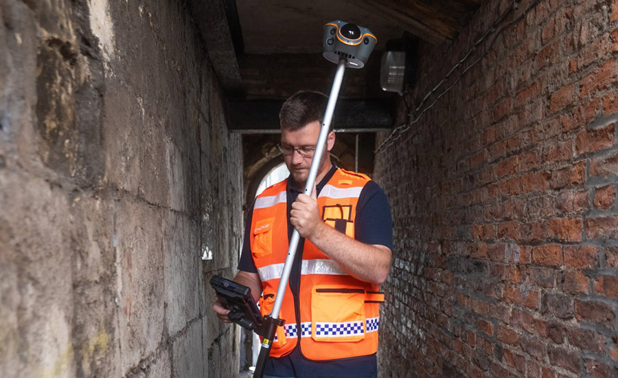
The ViLi i100 stands apart when GNSS signals are completely lost. Whether under bridges, inside short tunnels, or in deep excavations, the SFix 2.0 engine maintains survey-grade accuracy by referencing the last trusted GNSS position. Using its high-density LiDAR scanner, which captures 860,000 points per second, and advanced positioning algorithms, the system calculates current positions based on the surrounding environment. This enables continued 5 cm accuracy within a 20-meter radius of the last GNSS fix, even during total signal blackouts.
Trained and validated on thousands of real-world datasets, SFix 2.0 removes the need to switch to total stations for short-distance measurements in obstructed areas. It creates a seamless experience that brings GNSS reliability to environments once considered unreachable.
ViLi i100 in GNSS denied environment (Credit: Tri-site - UK)
With integrated Vi-LiDAR technology, the CHCNAV ViLi i100 enhances safety and efficiency by allowing non-contact data collection from points that are inaccessible or hazardous. Unlike photogrammetry, which requires extended processing time, or laser rangefinders that demand precise manual alignment, the ViLi i100 enables fast and accurate 3D coordinate extraction.
Surveyors can batch-select target points through the software interface for instant measurements. An 8-megapixel telephoto camera provides clear visual confirmation up to 15 meters, ensuring 5 cm accuracy. This reduces the risk of manual errors, eliminates vibration-related inaccuracies, and speeds up the capture of difficult features like overhead structures, building corners, or assets across traffic lanes.
Streamlined Earthwork Volume Calculations
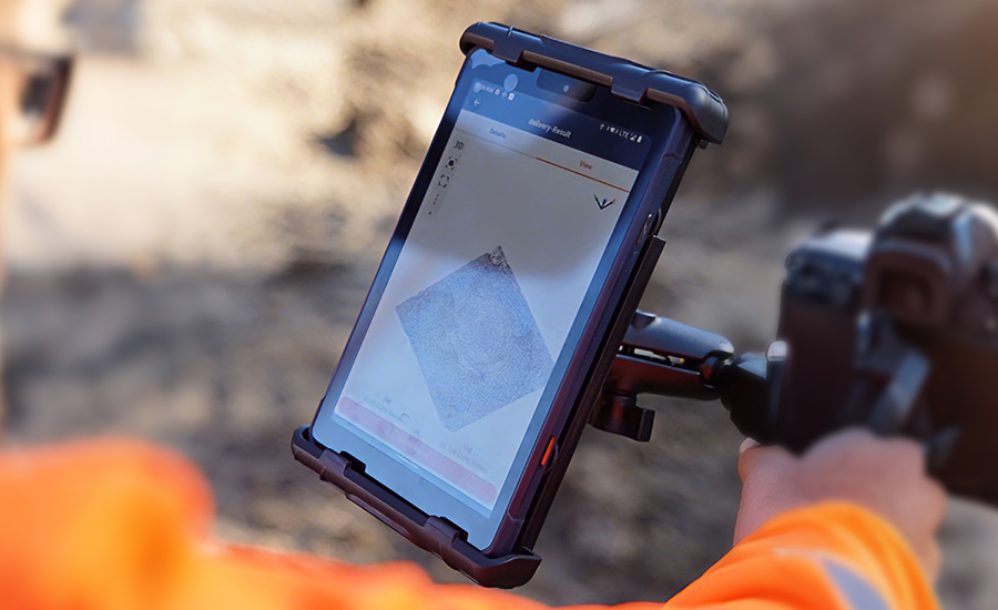
When paired with CHCNAV's LandStar8 field software, the ViLi i100 becomes a powerful tool for on-site earthwork management. A quick scan of stockpiles or excavation zones generates a dense 3D point cloud, from which users can define boundaries and instantly receive accurate cut-and-fill calculations. This real-time processing capability enables immediate validation and decision-making in the field, eliminating the delays of office-based post-processing.It simplifies workflows and brings efficient volume computation directly to the job site.
Technical Synergy: The All-Round Surveying Flagship
CHC Navigation development of the ViLi i100 builds on years of experience in GNSS chipset design, LiDAR technology, and photogrammetric algorithms.Following the success of the RS10 SLAM scanner, which introduced SFix 1.0 to maintain accuracy for up to one minute after GNSS loss, the ViLi i100 advances the concept with SFix 2.0. SFix 2.0 integrates high-precision IMU data, visual recognition, and dynamic LiDAR point cloud generation to construct a stable spatial reference frame. This synergy with GNSS ensures positional stability and maintains $5 cm absolute accuracy within a 20-meter radius of the last known position, even without satellite signals.
The system also introduces unique capabilities. With full 360-degree tilt compensation, the ViLi i100 allows measurements at any angle, including inverted use for ceiling points,surpassing the typical tilt limits found in standard receivers.
CHCNAV ViLi i100 vs. CHCNAV RS10
Feature / Scenario
CHCNAV RS10
CHCNAV ViLi i100
Product Positioning
Multi-purpose SLAM scanner with surveying capability
Flagship GNSS receiver with integrated multi-sensor fusion
Core Technology
SFix 1.0
SFix 2.0
GNSS-Denied Performance
Maintains 5 cm accuracy for up to 1 minute
Maintains 5 cm accuracy within 20 m radius continuously
Non-Contact Measurement
Supported
Enhanced for fast, survey-grade workflows
Real-time Volumetrics
Supported, with post-processing
Instant on-site results
Primary Design Focus
Large-scale 3D modeling, with basic survey support
High-precision surveying and stakeout in complex conditions
The CHCNAV ViLi i100 sets a new benchmark for GNSS receivers by combining advanced multi-sensor fusion with user-driven innovation. It directly addresses long-standing pain points in the field, offering consistent 5 cm accuracy even in environments where satellite signals are obstructed or lost.
For professionals in surveying, construction, or government sectors, the ViLi i100 delivers measurable gains in efficiency, safety, and reliability. It reflects CHC Navigation ongoing commitment to solving real-world challenges through precision technology.With the CHCNAV ViLi i100, the future of dependable, all-environment positioning is already here.
____
About CHC Navigation
CHC Navigation (CHCNAV) develops advanced mapping, navigation and positioning solutions designed to increase productivity and efficiency. Serving industries such as geospatial, agriculture, construction and autonomy, CHCNAV delivers innovative technologies that empower professionals and drive industry advancement. With a global presence spanning over 140 countries and a team of more than 2,000 professionals, CHC Navigation is recognized as a leader in the geospatial industry and beyond. For more information about CHC Navigation [Huace:300627.SZ], please visit: www.chcnav.com
Related Products
CHCNAV ViLi i100
Visual-LiDAR GNSS RTK receiver with consistent accuracy in obstructions